21st MAY 2015
ARTICLES | RELEASES
From Grappa to Cansiglio: the Alta Via of the Treviso Pre-Alps
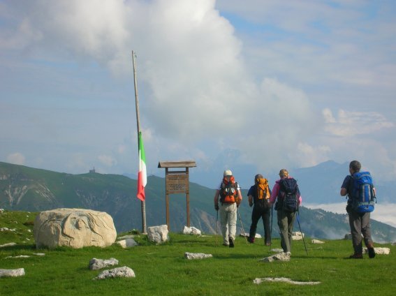
For those who love nature, there is nothing more soothing than walking the panoramic path of the splendid Treviso Pre-Alps. Go up and down the soft slopes and stop to admire the landscape. From Grappa to Cansiglio among the wonders of our territory. “Montagna di Marca” above all means this: excursions to discover mysterious and fascinating areas such as Monte Grappa, Monte Cesen, Col Visentin and Cansiglio. An area that can be tackled by walking, by mountain bike or, for horse riding enthusiasts, even on horseback. In addition, the possibility of making tasting stops to seek refreshment in the alpine huts and taste the typical products of the area, along the pre-established routes.
From Grappa to Cansiglio, the Treviso mountains are made up of a varied natural environment, sometimes tamed by the hand of man, sometimes still wild.
The Monte Grappa massif and the Piave river that divides it to the east from the Monte Cesen-Monte Visentin ridge, remind us of a territory tormented during the First World War, but also the decisive bulwark for the fate of the war. Homeland pride is identified with these places, with a mountain that, rising from the plain with a single leap up to 1775 meters high, is an anticipation of the Alpine chain behind it, dividing two completely different worlds and offering panoramic suggestions, in the their contrast, of extraordinary effect. The climatic and environmental diversities favor the development and spread of a particularly varied and abundant flora and fauna and the numerous valleys that break their compactness offer enthusiasts a wide range of possibilities: from an easy excursion to a demanding one, from a visit from places of historical importance to the opportunity to take flight on a hang glider or a paraglider, to that of experimenting with rock climbing and more. Beyond the Piave the Treviso Prealps continue in their corrugation dividing the Val Belluna, and therefore the Dolomites, from the hills on the left Piave della Marca which, like those on the right, are rich in history, culture and food and wine traditions. From Monte Cesen to Monte Visentin, with an altitude ranging from 706 m. of the narrowing of the San Boldo Pass to the 1763 of Monte Visentin, the pre-alpine ridge, thinner than that of Grappa, which is not surprisingly defined as massive, is configured in a serrated manner with a series of small peaks in succession, reachable by they depart directly from the inhabited centers below. Mount Visentin divides to the east towards the wide Sella di Fadalto beyond which we find another microcosm consisting of the Cansiglio, which with its forest represents one of the most important places in the entire Alpine arc from a naturalistic and botanical point of view. culminating is Monte Pizzoc at 1547 meters high.
The entire ridge of the Treviso pre-Alps can be covered thanks to a path, marked by the Province of Treviso with the indication of TV1, which represents a real Alta Via. The reasons and stimuli for approaching the Treviso mountains have multiple values: from the search for a relatively little frequented environment to the opportunity to cultivate a passion for the mountains in the intermediate seasons, that is, between winter skiing and summer hiking, typical of the Italian mountains. high altitude, without solution of continuity, but rather taking advantage of a composite territory in which sporting activity can alternate with the cultural one. Visiting the numerous places of historical, artistic and naturalistic importance certainly offers a further incentive to visitors looking for alternative destinations and pleasant places outside the well-established but also over-crowded tourist circuits.
The Alta Via of the Treviso Pre-Alps
Distinguished by the initials TV1, the panoramic trail of the Treviso Pre-Alps presents itself as an ideal Ariadne’s thread capable of combining all the valuable aspects of this long series of peaks that are in many ways really interesting. It should be remembered that, with minimal adaptations, the route can be tackled on a mountain bike, rather than on horseback. The entire path, 112 km through Monte Grappa, the Monte Cesen – Col Visentin ridge and the Cansiglio forests, takes 10 days, but being naturally divided into 4 well-defined realities, it lends itself well to being experienced in a series of end weeks, more or less long, in logical succession (Monte Grappa, from Cesen to Passo S.Boldo, from Passo S. Boldo to Fadalto through the Visentin, from Fadalto to Vittorio Veneto along the Cansiglio – or vice versa).
Bibliographic material
The Province of Treviso has produced a dedicated map guide indicating the entire route and a good description of the individual stages. In any case, it is advisable to also acquire the following “cartographic kit”: – Guide to the panoramic path “from Grappa to Cansiglio”, Alta Via Trevigiana, Provincial Agency for Culture and Tourism (1: 50.000) – The Massiccio del Grappa trail map, ed. SELCA (1: 30.000) – Map of itineraries LE PREALPI TREVIGIANE, ed. The Way (1: 25.000) – Belluno and Treviso Prealps, Map n ° 4, ed. LagirAlpina (1: 25.000) – Prealps and Belluno Dolomites, Sheet n ° 024, ed. Tobacco (1: 25.000) – Alpago-Consiglio-Piancavallo-Val Cellina, Sheet n ° 012, ed. Tobacco (1: 25,000).