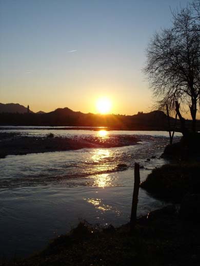
From the sources to the sea, the one that the Piave makes from prehistoric times is a whole Veneto journey. From Mount Peralba on the Carnicas of Sappada at an altitude of 2037 meters until it calms down to the Adriatic between Eraclea and Jesolo after 231 kilometers. On the left of the mouth is the Laguna del Mort, an enclave of sea water built in the area of a dead arm of the river. It is the fifth river in Italy by length among those directly flowing into the sea, in ninth place in the ranking of Italian rivers.
A stream that marks the rhythms of life and history of this corner of the territory: not for nothing on the occasion of the first centenary of the Unification of Italy, the Municipality of Sappada erected a stone stele on the source of the Piave.
The river is entirely contained within the borders of the Veneto, despite the basin partially touching the provinces of Pordenone, Trento and Bolzano. It crosses the Comelico, Cadore and Valbelluna in the Province of Belluno and the Venetian plain in the provinces of Treviso and Venice, touching the towns of Valdobbiadene, Nervesa della Battaglia, Colfosco, Ponte della Priula, Maserada sul Piave, Breda di Piave, Ponte di Piave, San Donà di Piave, Eraclea and Jesolo.
The first steps from the stream do not last long for the Veneto river, adolescence becomes adult after a few kilometers: despite the presence of numerous hydroelectric basins, the influx of water conferred by mountain streams remains of great importance.
After having traveled the first kilometers in a southerly direction, at the height of Cima Sappada the river bends west, crossing Sappada and subsequently receiving the contribution of important streams such as the Piave di Visdende. After Sappada, it enters a deep gorge (the Acquatona ravine) and then continues its run up to Santo Stefano di Cadore, downstream from which it meets the Padola. Here begins a stretch that will bring it back (from the locality of Cima Gogna, where it receives the Ansiei) to flow southwards to Ponte nelle Alpi. In this long stretch the river crosses the territories of the municipalities of Centro Cadore (Lozzo, Domegge, Calalzo and Pieve) forming the large lake of the same name. Downstream of the dam, in Perarolo di Cadore, it receives the waters of the Boite. The river remains in an overall narrow valley crossed by the railway leading to Calalzo and by the Alemagna state road. At the height of Castellavazzo it emerges into the wide Valbelluna and immediately after, in Longarone, it receives the Vajont from the left and the Maè which descends from the Zoldo valley from the right.
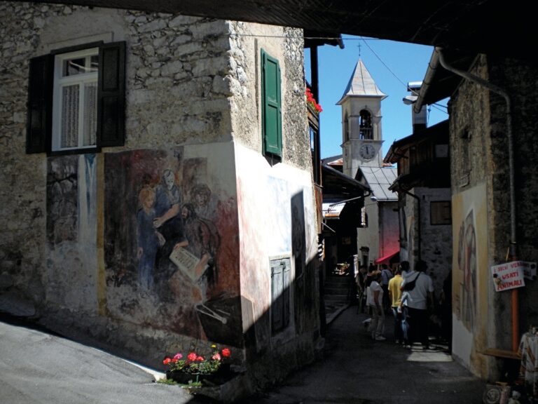
Here we open a small parenthesis and point out the Zattieri museum which is located in Codissago, a hamlet of Castellavazzo, 6 km from the A27 Venice-Belluno motorway exit on the left bank of the Piave in front of Longarone. The raftsmen were the specialists in the transport of logs along the river, “flocks” of fir trees that were tamed while remaining on rafts. From 1492 to 1942 the floating of timber was an authentic source of work for this corner of Veneto. At the end of the 1700s this system was consolidated and Venice could count on a quantity of timber equal to 350,000 logs every year.
Resuming our path, at Soverzene (where one of the most important hydroelectric plants in Europe is located) the course is blocked and partly diverted. Following Ponte nelle Alpi, it turns south-west, crosses Belluno and north of Mel receives the copious waters of the Cordevole. It then continues its run through Busche (municipality of Cesiomaggiore) and downstream of the bridge-dam that forms the lake of the same name it receives the waters of the Caorame.
Afterwards, it leaves the Valbelluna and enters a narrower valley, along which it receives the Sonna, the stream that crosses Feltre.
When it goes around Montello from the north, here is the historic river, the Piave theater of the Great War. It is here that the stream becomes a symbol, here where, in the famous song “he murmured calmly and placidly as the first foot soldiers passed ..”.
Between Segusino and Pederobba it leaves the area between the Alps and the Pre-Alps and enters the Venetian plain. In this part the course of the river bends to the south-east and will maintain this direction until Cortellazzo, where it flows into the Adriatic Sea. The only important tributary it receives outside the province of Belluno is the Soligo.
In the flat section the river loses much of its water due to water withdrawals and infiltration and the bed can widen up to several kilometers. It is also in these areas of high naturalistic interest that beaches for tourists have been created, to allow safe bathing.
In the last stretch the Piave is as if channeled, following the interventions of the Republic of Venice which diverted its course to the east to save the lagoon, and reaches the sea at Cortellazzo. The old branch of the Piave still exists today, reaches the Venice lagoon and mixes with the waters of the Sile.